The Solomon Islands plans to bring its first national weather radar into service on 4 December 2026, giving forecasters a new tool for tracking storms and intense rainfall as the tropical cyclone season begins. A government announcement on 12 November values the project at SBD 20 million — Solomon Islands dollars, not US dollars. The radar is not yet operational: 4 December remains a planned launch date. Officials say its C-band data will support the Solomon Islands Meteorological Service’s early-warning work, including severe-weather monitoring, flood-warning capability and aviation weather. [1]
A national first, with a date still ahead
The Solomon Islands Government describes the installation as the country’s first weather radar system. The equipment is being prepared for launch at Henderson, near Honiara International Airport, and is expected to become operational after the launch on 4 December. As of the 12 November announcement, it had not entered service; the date is a future target, not a report of an operating system. [1][3]
The timing coincides with the South Pacific tropical cyclone season. Officials say the project will strengthen national early-warning services and severe-weather monitoring. The radar will provide additional observations for meteorologists; it will not prevent storms or flooding. [1]
Sources: Timely Boost for Cyclone Season: Solomon Islands on Track to Launch Country’s First Weather Radar System · SIMS and CAASI Signed a Land Use Agreement to Construct First C-Band Weather Radar Station in Solomon Islands
What the radar is expected to observe
The government identifies the instrument as a C-band weather radar. Its 12 November announcement says it can scan up to 200 kilometres and lists its intended uses: tracking storm systems, localised thunderstorms and tropical cyclones, and estimating rainfall intensity, location and storm size. Officials say the observations could also support the establishment of a national flood early-warning system. That is a stated objective, not evidence that a complete flood-warning service is already operating. [1]
Published range figures differ. A government announcement in February 2026 described a 300-kilometre scanning range; the November announcement gives up to 200 kilometres. Neither the February nor the November Government announcement explains whether the two figures reflect different technical measures, configurations or revisions. This article uses the latest government figure while recording the discrepancy. Neither figure is a published map of the areas that will receive reliable observations. [1][2]
The November statement also names aviation weather and maritime transport among the expected beneficiaries. It does not specify a fisheries application, public radar-feed arrangement or guaranteed warning lead time. Those claims should not be added without further official information. [1][3]
Sources: Timely Boost for Cyclone Season: Solomon Islands on Track to Launch Country’s First Weather Radar System · Solomon Islands to Boost Meteorological Capabilities with New Advanced Weather Radar · SIMS and CAASI Signed a Land Use Agreement to Construct First C-Band Weather Radar Station in Solomon Islands · Awareness on New Advanced Weather Radar Underway
Why an additional observation tool matters
The Solomon Islands Meteorological Service already issues public and marine forecasts, tropical cyclone and flood warnings, and aviation weather information. Radar would add near-real-time information about precipitation and storm development; it would not replace weather stations, satellite products, forecasters or the agencies that communicate and respond to warnings. [7]
The distinction matters in an island country exposed to tropical cyclones, severe winds, heavy rain, flash flooding and coastal storm surges. Radar images can help forecasters see developing rain bands and thunderstorms around the site, but their value depends on interpretation and communication. The government says the system will strengthen SIMS’s warning capacity and support aviation weather and maritime transport. [1]
Sources: Timely Boost for Cyclone Season: Solomon Islands on Track to Launch Country’s First Weather Radar System · Our Services
A New Zealand-backed regional project
The government values the radar project at SBD 20 million. It says the New Zealand Government is funding the system through the Pacific-led Weather Ready Pacific programme, coordinated by the Secretariat of the Pacific Regional Environment Programme (SPREP) and endorsed by the Pacific Meteorological Council. The November announcement says New Zealand’s MetService has provided technical and engineering support since 2024, working with SIMS staff in the Solomon Islands. [1]
The programme aims to strengthen meteorological services and multi-hazard early-warning systems across Pacific island countries. New Zealand MetService’s 2025/26 annual results report confirms that construction began on a Solomon Islands radar project through Weather Ready Pacific, supported by New Zealand’s Ministry of Foreign Affairs and Trade. The SBD 20 million valuation cited here is the amount published by the Solomon Islands Government. [4]
Weather Ready Pacific has several regional partners and donors, but the Solomon Islands Government specifically identifies New Zealand as the funder of this radar. The programme’s wider donor list should not be mistaken for the funding attribution for this installation. [1][3]
Sources: Timely Boost for Cyclone Season: Solomon Islands on Track to Launch Country’s First Weather Radar System · SIMS and CAASI Signed a Land Use Agreement to Construct First C-Band Weather Radar Station in Solomon Islands · MetService Annual Results Announcement (FY26) · Solomon Islands on Track to Becoming ‘Weather Ready’ with New Radar by End of 2026
From site agreement to construction
In August 2025, SIMS and the Civil Aviation Authority of Solomon Islands signed a land-use agreement allowing construction at the authority’s Henderson compound. The government said the C-band radar would support real-time monitoring, severe-weather and flood early warnings, and aviation weather services. The agreement gave the long-planned project a defined installation site. [3]
By February 2026, the government said some equipment had arrived in Honiara. Preparatory milestones included unexploded-ordnance clearance, an environmental-impact assessment and geotechnical surveys; construction was also subject to a Guadalcanal provincial permit. MetService later reported that construction had begun during the 2025/26 financial year. SPREP’s programme reporting described the tower’s concrete foundation as complete and a dedicated solar-power supply being installed. [2][4][5]
The Island Sun reported in October that commissioning was expected before the end of 2026. It also noted that long-term value would depend on SIMS’s ability to operate and maintain the system and communicate warnings. The 12 November government announcement now gives a target date of 4 December. [6]
Sources: Timely Boost for Cyclone Season: Solomon Islands on Track to Launch Country’s First Weather Radar System · Solomon Islands to Boost Meteorological Capabilities with New Advanced Weather Radar · SIMS and CAASI Signed a Land Use Agreement to Construct First C-Band Weather Radar Station in Solomon Islands · MetService Annual Results Announcement (FY26) · Solomon Islands on Track to Becoming ‘Weather Ready’ with New Radar by End of 2026 · Solomon Islands’ First Weather Radar Targets Year-End Commissioning · Awareness on New Advanced Weather Radar Underway
What commissioning will — and will not — settle
The scheduled launch is a milestone, not the end of the work needed to use radar observations effectively. The 12 November announcement does not provide a detailed coverage map, data-sharing plan, maintenance arrangements or performance results. The 200-kilometre and 300-kilometre descriptions also remain unreconciled. Neither figure should be turned into a claim that the radar will cover every island or community. [1][2]
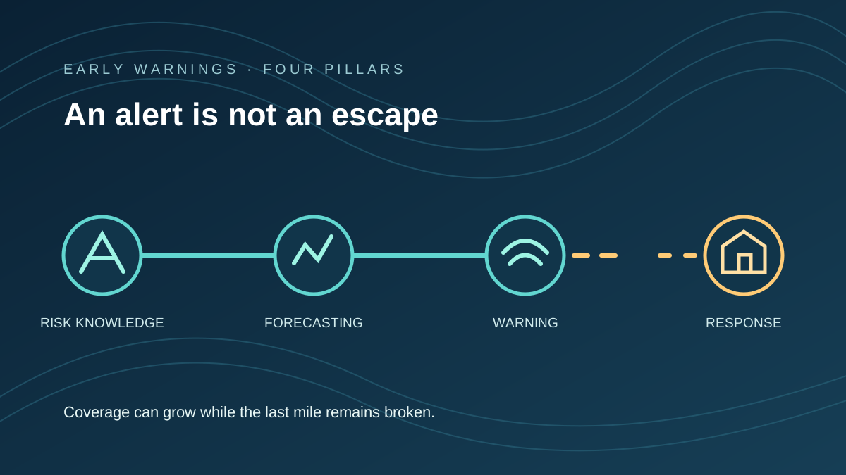
After 4 December, the tests will be whether the equipment is commissioned as planned, SIMS can sustain its operation, and radar observations reach forecasts and warnings in time for people to act. The project is designed to strengthen that chain, especially for severe rain, storms and aviation weather. An installation alone cannot guarantee early action: communications, preparedness, trained staff and response capacity remain essential. The defensible news is that the country’s first national weather radar is scheduled to enter service on 4 December, backed by a SBD 20 million investment and a regional partnership. [1][4][6]
Sources: Timely Boost for Cyclone Season: Solomon Islands on Track to Launch Country’s First Weather Radar System · Solomon Islands to Boost Meteorological Capabilities with New Advanced Weather Radar · MetService Annual Results Announcement (FY26) · Solomon Islands’ First Weather Radar Targets Year-End Commissioning